
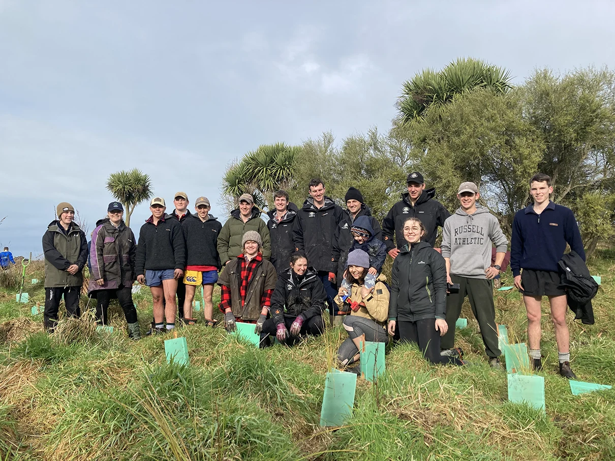
The Waitarakao Washdyke Catchment is just north of Timaru in South Canterbury. At its heart is a special lagoon and a community on a mission to restore its mauri (life force).
After 18 months of community engagement, a strategy was developed and adopted by four partners: Te Rūnanga o Arowhenua, Timaru District Council, the Department of Conservation and Environment Canterbury.
The strategy outlines first steps and ongoing actions to improve both the lagoon and the wider catchment. It includes measures to increase natural hazard resilience, address poor water quality, and improve biodiversity to enhance the long-term future of the lagoon and surrounding areas – including adjoining creeks and nearby wetlands.
The partners and community worked together to address the catchment holistically and make an ambitious but realistic plan for its future. Environment Canterbury Chair Craig Pauling says the adoption of the strategy signifies a shared commitment to working towards the long-term health and sustainability of Waitarakao.
‘Waitarakao is quite a rare coastal environment in this region, with unique ecosystems and important habitat for wildlife,’ says Pauling. ‘The community and our partners are taking this restoration seriously – it’s a great example of collective action for the environment.’
A diverse catchment
Waitarakao Lagoon is a shallow, brackish, coastal lagoon on Kā Poupou-a-Rakihouia, on the South Canterbury coastline. Its importance stems from its rare geomorphology, native ecological habitats, biodiversity, and cultural and historical values. The lagoon is a feature of the Washdyke and Timaru coastlines, but is influenced by a larger catchment area involving a diverse range of ecosystem types, land uses, and recreational activities.
The Waitarakao catchment has four major inland streams – Papaka, Rosewill, King Road and Oakwood – and several small tributaries that merge into Washdyke Creek before entering the lagoon environment. A coastal portion of the catchment extending northwards from the lagoon includes the Seadown drainage scheme, which provides a major source of fresh water to the lagoon. There is also a significant network of irrigation and drainage features on the Levels Plain.
The catchment contains regionally significant industry, critical infrastructure, two designated mātaitai areas, a wildlife refuge, farming, residential properties, and significant environmental and recreational opportunities. It has a long history of cultural use and represents one of the few remaining coastal environments of its type in the region.
An area in decline
The landscape has been substantially modified through land‑use changes, including the installation of Timaru Harbour breakwaters and drainage, altering of waterways, and the addition of infrastructure and buildings. In the early 1880s, the lagoon was approximately 250 hectares; now, it generally occupies an area of around 50–60 hectares.
For most of its history, the lagoon did not have a permanent mouth to the sea, and the lagoon and adjacent swampland were much more extensive than they are today.
The gravel barrier beach that separates the ocean from the lagoon has retreated more than 400 metres since 1865, and is continuing to retreat. Meandering streams feeding the lagoon have been highly modified, and drainage and land use have removed many off-channel freshwater areas of swamp and wetland.
Remaining coastal wetland and lagoon environments are critical mahika kai environments, and unique and important habitats for a range of wild flora and fauna. Mahika kai is a central element to Ngāi Tahu identity and wellbeing, and is considered an important environmental indicator.
Te Rūnanga o Arowhenua believes that all bodies of water within their rohe should be suitable for mahika kai; however, environmental degradation has seriously impacted the ability to gather resources and to impart knowledge through generations within the catchment.
For the longest time, Waitarakao Lagoon had the perfect mix of salt water and fresh water, allowing a diverse range of native species to thrive there; however, the lagoon has shrunk, and its health, and the habitat of the wildlife, is declining.
It became clear that the area was at a tipping point – without intervention, it would soon be too late.
Community involvement
The process of creating the draft strategy included working closely with the local community and relevant stakeholders. A wealth of information, ideas and stories were captured through a series of community drop-in events, stakeholder meetings, an online survey, and focused community workshops.
The draft strategy reflected the input from the Timaru community, which was overwhelmingly supportive of getting involved and contributing to the whole catchment’s improved health.
‘We knew we would need the support of the community to help create a strategy that was in line with people’s values, but also practical and realistic,’ says Timaru District Council Steering Group representative Paul Cooper. ‘The ideas and knowledge from community members was fantastic. We had people from rural backgrounds, industry, te ao Māori, conservation, and education who added a lot to the technical and cultural knowledge of our project partners.
‘The momentum that’s already underway to improve the catchment has been beyond what we expected. At the same time, as we were developing the strategy, we have also been able to encourage on-the-ground action that we’re already in agreement with, such as supporting local school visits to the lagoon, organising rubbish clean‑ups, undertaking fish habitat surveys and enhancing predator trapping.’
Next steps
The strategy is being implemented through first steps and ongoing actions, which are being carried out with the help and involvement of the community.
The positive way in which partner agencies and the community have collaborated so far has established the standard for how they are continuing this important work together.
Businesses, landowners, and the community are sharing resources and combining in positive actions in the catchment – things like riparian plantings, pest and weed control, sponsoring projects, and donating resources and volunteer time.
For more information, visit www.ourwaitarakao.co.nz.
About Our Waitarakao
Our Waitarakao is a collaboration between the community and the four partner organisations to deal with problems faced now in this unique coastal catchment, as well as planning ahead for a time when erosion may reduce the lagoon to a much smaller size. The strategy includes actions to improve water quality, biodiversity and natural hazard resilience, as well as an ambitious long-term approach to create pockets of new wildlife habitat.