
Content provided by Mangatangi Maramarua Catchment
A positive, collaborative collective drives change.
Near the Whangamarino Wetland and the Firth of Thames, surrounded by the Hunua Ranges, lies the Mangatangi and Maramarua Catchment. It’s 19,500 hectares of pastoral farmland and native bush, including the Mangatangi Dam, which provides much of Auckland’s water supply.
The region was one of the first to be targeted with Waikato Regional Council’s Plan Change 1, aimed at improving water quality, in addition to the certified farm environment plans – a requirement for every farm in Aotearoa New Zealand that was introduced by the previous government. The Mangatangi Maramarua Catchment was formed in response to this increasing legislation from both local and national governments, and its potential to impact farming operations. The group developed a strategic vision to protect and enhance the Mangatangi Maramarua environment by involving the whole community, aiming to tackle the task of water quality head on.
The community group works as a local facilitator for improving water quality, biodiversity and kaitiakitanga (guardianship). They meet regularly to plan, exchange ideas and knowledge, and host community events led by industry experts across a wide variety of subjects.
‘We are one of 74 catchments supplying the Waikato River, and water quality has been a primary focus of our efforts,’ says Will Murphy, Mangatangi Maramarua Catchment Chair.
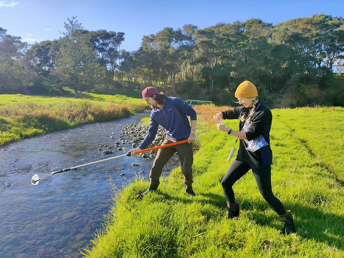
The catchment recognised that a better understanding of the freshwater health of the waterways was a good starting point, and wanted local scientific data. The group engaged ecologist Merrin Whatley to carry out quarterly water sampling at 12 sites throughout the catchment, including two real-time Adroit stations.
Water samples were collected and assessed for clarity/suspended sediment, phosphorous, nitrogen and E. coli. A recent significant milestone was achieved when a year’s worth of water sampling had been gathered.
The catchment tracks biodiversity via environmental DNA (eDNA) testing at seven sites, and combines this with the freshwater invertebrate tracking by Watercare, and Waikato Regional Council’s fish and invertebrate survey, to build a comprehensive picture.
The eDNA provided insights into overall waterway health, and was mapped against the Macroinvertebrate Community Index, the Fish Index of Biotic Integrity and the Taxon‑Independent Community Index.
‘The data shows a positive picture, with several levels meeting or above the national standards,’ says Murphy.
Seventy-four per cent of New Zealand’s native fish species are threatened or at risk of extinction. One of the unexpected highlights of the eDNA was the detection of seven native fish species. Kōura and freshwater mussels (in particular, the Echyridella aucklandica, which is‘vulnerable to extinction’) were identified, and longfin eel were found throughout the waterways.
Unique catchment characteristics
‘We learnt that we have substantially varying results from across the catchment. The impacts of topography, flow, land use, soil type and weather all matter. We want to go further,’ says Murphy.
The catchment is now looking at how additional investment in landscape DNA could provide greater understanding of the complexities of waterway health and help fine-tune efforts. ‘It goes well beyond just land use,’ adds Murphy.
My Living Catchment
The catchment has also invested in a web-based technology called My Living Catchment, which is an online tool accessed by residents to capture weather events, water monitoring results, farm activity, plantings, and sightings of pests and native birds, among other features. It forms a central repository for important historical information, including rainfall records, dating back to 1962 – information that can be used to guide future actions.
A multi-layered approach
Measuring water quality and habitat is one of three core themes within the catchment’s strategic goals. A recent pest and predator survey identified a need for a community‑wide pest strategy, and an upcoming biodiversity audit will build a greater understanding of the natural catchment characteristics and long-term challenges ahead.
The long game: working together towards better environmental outcomes
‘Working closely with all residents is key to maximising the engagement and effectiveness of all our initiatives,’ says Robyn Budd, Mangatangi and Maramarua Catchment Coordinator. Building knowledge and capability within the community allows for informed decision-making, and helps address the complexities of the catchment’s unique water quality landscape.
At a recent community meeting, Whatley presented the water quality results, and outlined future opportunities and support for the native uncommon species. The focus was on cost-effective on-farm actions and practices, pest control, and support for native habitats. An evolutionary, not revolutionary, approach that will help support sustainable initiatives will provide the greatest achievable long-term benefits.
Photograps courtesy of Adaptive Environmental Consulting.